Ice allows for continued sediment mapping of lake Erssjön at Skogaryd
01 February 2021
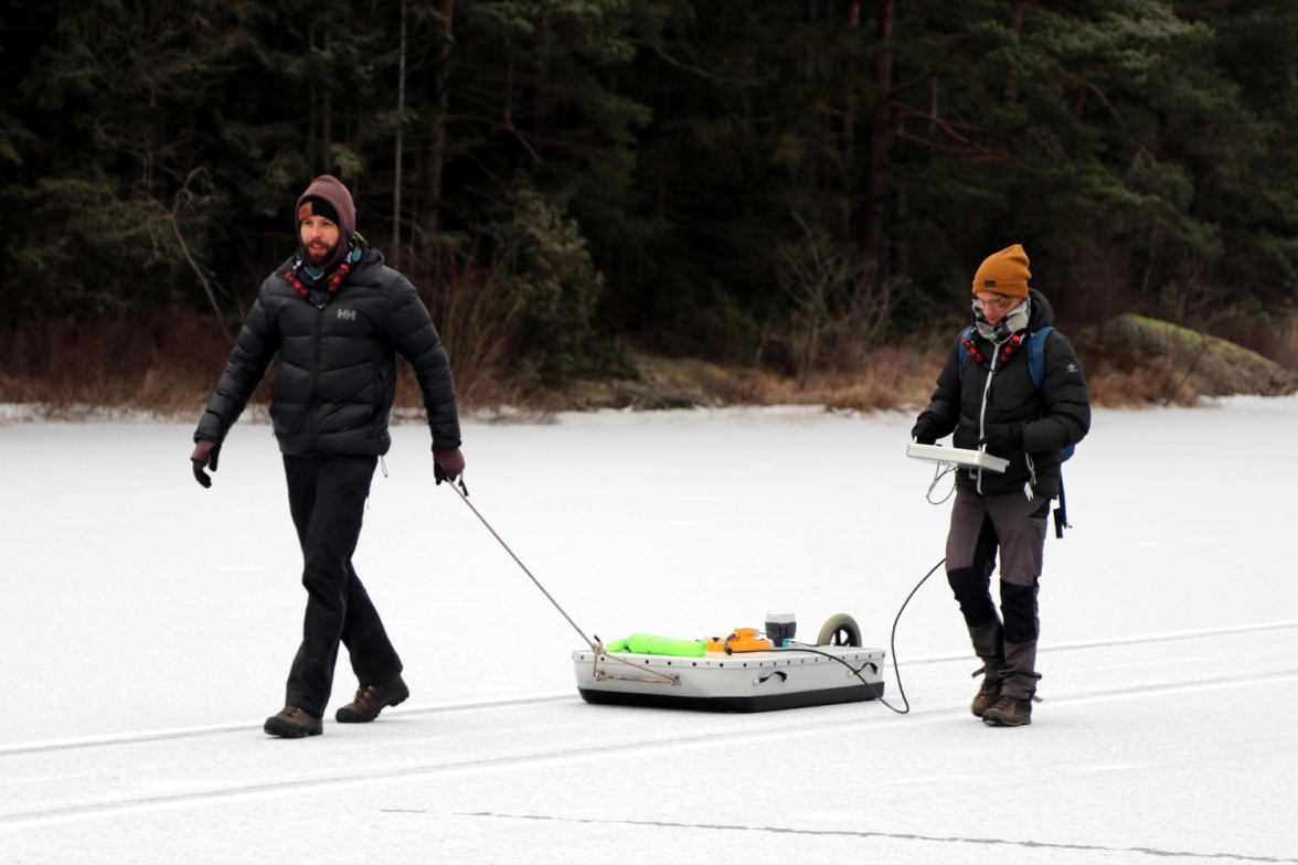
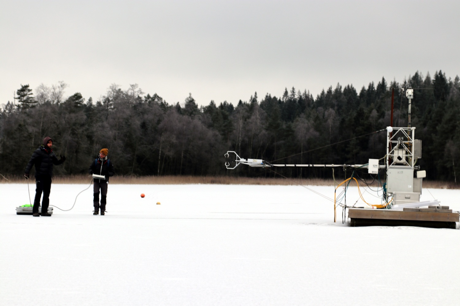
Two master students, Fredrik Andersson and Tobias Möhl, participated in the sampling. Here they are pulling the geo-radar (Malå Geoscience Ramac) equipment over the ice. Photo: Leif Klemedtsson.
Sediment investigations that enable a better understanding of biogeochemical processes are ongoing in the thematic program SITES Water.
During the autumn 2020, an initial sediment investigation was conducted at Lake Erssjön and Lake Feresjön (see SITES December Newsletter for more information). To determine the sediment depth a sub-bottom profiler (Innomar SES-2000) was used. The profiler uses acoustic signals of different wavelengths to produce images showing bottom surface, sediment layers and underlying bedrock. However, gas bubbles in the sediment layers can make it difficult to interpret the bottom profile images and the bubbles can mask the bedrock transition zone. To counteract these issues, during the initial campaign, surface sediment was collected from many locations and deep sediment sampling was carried out at the deepest point of the lake. Two master students, Fredrik Andersson and Tobias Möhl, participated in the sampling. Here they are pulling the geo- radar (Malå Geoscience Ramac) equipment over the ice. Photo: Leif Klemedtsson.
Data from the initial sediment sampling of Feresjön identified the depth of the soft sediment layer, however some areas were shadowed by bubbles. For Erssjön the data was more difficult to interpret, which, in part, was due to data shadowed by bubbles.
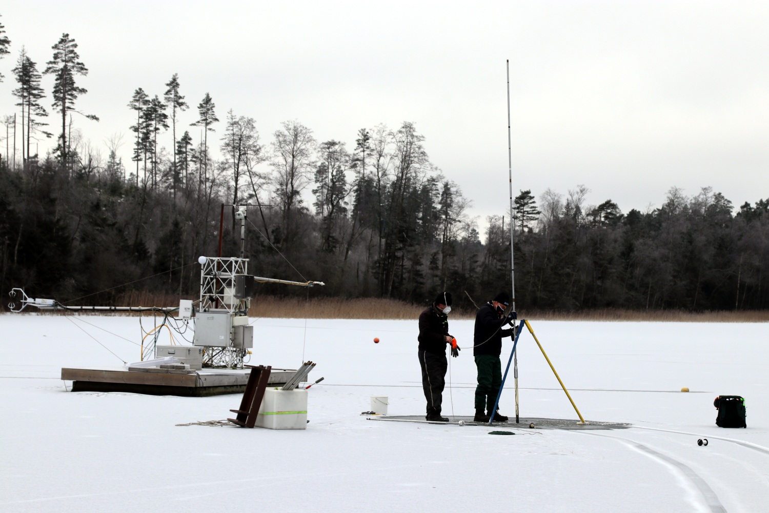
Thus, additional data from Erssjön is needed to interpret the data. Fortunately, the ice-cover that formed in January 2021 on Erssjön made further investigations possible, as a stable platform is required for working with deep sediment cores. Some of the sediment sampling was done close to the platform used for measurements in SITES Water. Photo: Leif Klemedtsson.
Deep sediment sampling at the deepest point of the lake, using a “Livingstone” corer, was conducted. Five locations were also sampled for sediment to assist the interpretation of data from the sub-bottom profiler. Furthermore, a geo-radar was tested. Sediment depth mapping using a geo-radar could potentially compliment and improve future campaigns.