An ecosystem monitoring program collecting spectral data and producing data products
SITES Spectral offers
SITES Spectral monitors ecosystems using a variety of instruments, including fixed multispectral sensors, phenological cameras, multispectral Unmanned Aerial Vehicles (UAVs; drones), and satellite data. With those instruments we provide remote sensing derived products at different scales:
- Times-series of vegetation data
- Image products
- Maps of vegetation indices
- Spectral measurements for validation and calibration of remotely sensed data
Description of the infrastructure
The SITES Spectral infrastructure is distributed across Sweden. It facilitates comprehensive environmental monitoring at different spatial and temporal scales, and forms a unique and invaluable resource for upscaling via remote sensing satellites. Phenocams capture seasonal changes across diverse habitats, while fixed multispectral sensors capture seasonal and inter-annual variations in vegetation conditions over targeted areas. The UAVs, equipped with multispectral and RGB cameras, capture aerial imagery, and contribute to building aerial mosaics, surface terrain models and high spatial resolution maps that can be used for spatial analysis. Satellite data products, expected in 2024, offer data at 10 m spatial resolution, and presents a broader perspective, enhancing our comprehension of vegetation spatial variability and phenology dynamics in the SITES spectral network of participating stations.
While the current emphasis is on vegetation, SITES Spectral coverage is extending to include water and snow conditions. All of the SITES stations participate in SITES Spectral to varying degrees.
The following stations participate in Spectral:
- Abisko
- Asa
- Erken
- Grimsö
- Lönnstorp
- Röbäcksdalen
- Skogaryd
- Svartberget
- Tarfala (from 2013-2022)
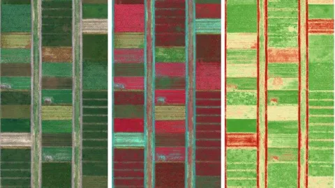
Multispectral sensors
Stations typically have 2-4 fixed multispectral sensor locations, which cover typical vegetation types, e.g. forest, peatland, mountain heats and agricultural lands. All fixed sensors are mounted in masts/towers for best possible overview of the vegetation, and measure light reflected from the plant canopies year-round. Fixed sensor data products include time-series of daily reflectance and spectral vegetation indices.
Phenological cameras
Each station is equipped with at least one phenological camera (PhenoCam), located in different ecosystem types and habitats within SITES e.g., agricultural fields, lakes, alpine heath, and forests at different development stages. Phenocams are used for phenological monitoring as well as for comparing and validating information from the fixed spectral sensors and UAVs. They provide useful data for visually observing seasonal and interannual vegetation variations at the stations. Phenocam data products include green and red chromatic and red-green-blue (RBG) products as well as quality filtered photos.
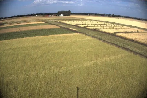
Unmanned Aerial Vehicles - UAVs
UAVs (drones) are flown over targeted areas at the SITES stations at least once per year during the peak of the active growing season. The UAVs are equipped with a multispectral and a red-green-blue (RGB) camera. These cameras capture images in the visible and near-infrared wavelengths. UAV data are calibrated against stable reflectance targets and products include orthomosaics, digital elevation models and point clouds over the drone flight path.
Satellite Data
SITES Spectral is developing seasonal data from the Sentinel-2 satellite constellation for all the stations, at 10 m spatial resolution. These data describe the phenological vegetation status and variations for extensive areas surrounding each station. We utilize quality-controlled data sets from Copernicus, transformed to the Swedish coordinate system. This data set is expected to come online during 2024.
Contact

Spectral Resources
SITES Spectral data available on the Data Portal
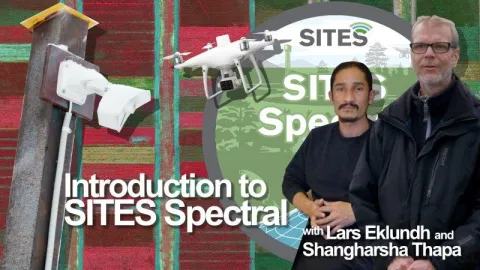
Introduction video about SITES Spectral
Documentation on data quality flagging for SITES Spectral