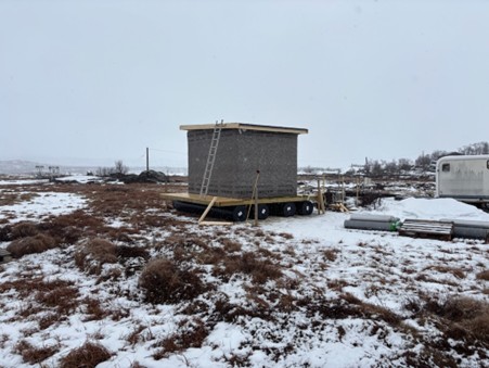
 The Stordalen mire, located 10 km east of Abisko Scientific Research Station, has for decades been a hot spot for greenhouse gas (GHG) measurements. The mire is underlain by lowland permafrost, i.e. the ground is frozen year-round. However, the permafrost is thawing in the area, and some monitoring platforms have started to tilt and sink because of the resulting unstable and wet ground. To adapt to these new conditions, a new floating monitoring platform has been built in Stordalen to ensure continued monitoring of GHG in a landscape in transition.
Interested in tracking Stordalen in transition? As part of SITES Spectral, UAVs are flown over the mire during different years and the resulting Digital Terrain Elevation Models (DTM) and Orthomosaic images of Stordalen Mire can be openly accessed on the SITES Data Portal.
The new monitoring platform on the left and the old monitoring platform that is being replaced to the right (Photo: E. Lundin).