Browning of surface water, rivers and lakes is a major problem that affects the ecosystem and the water quality. For example, increasing browning reduces biodiversity in lakes by reducing the fish population and therewith the food web. Browning also lowers the recreational value in tourism and requires higher effort to produce clean drinking water. Due to its complexity and the relatively young research field on browning in waters, the governing processes and their interrelationship are not fully understood yet. But to mitigate the effect of browning, these processes need to be understood and suitable measures needs to be taken.
Therefore, two research projects in the lake Bolmen area are ongoing. One is the FORMAS financed Blue innovation project with Lagan water council, Bolmen Research station and Lund University as partners. The second project is the EU Interreg North Sea region Blue transition project with 24 partners from 6 European countries, including the Swedish Geological Survey (SGU), Bolmen Research station/Sydvatten and Lund University. In both projects the purpose is to develop a toolbox for mitigation and verification of methods that have been tested to be efficient for reducing the browning of lakes. It is expected that these measures are transferrable to many other lake systems since the problem is widespread in Sweden as wells as in other countries.
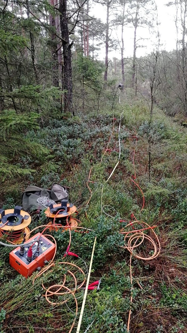
One of the main aims is to establish a good communication channel between the property owners and stakeholders in the Lagan water region. That is done by organizing workshops, for example at Bolmen Research station, and regular reference group meetings with stakeholders. To understand the underground hydrogeological conditions and to adapt it on a large scale, geophysics in combination with other sensors and in-situ investigations will be used. That has been done already for reconnaissance purposes (photo above) to get information, for example, about the thickness of the soil layer and the depth of the bedrock (figure below). After identifying suitable test sites, a monitoring system will be setup to run over several years to investigate the influence of the browning on the hydrogeological system. Based on that, mitigation strategies and measures will be developed and tested in a latter step.
News item was written by Tina Martin - Researcher and project leader at Engineering Geology at Lund University.