Last week, Holger Villwock from the SITES Secretariat took the chance for a short summer break from the office work to visit the SITES station in Skogaryd. The goal was to better understand the installations behind the data which are currently structured for uploading on the SITES Data Portal and also to work on data to prepare the upload. Leif Klemedtsson the station manager and thematic programme coordinator of SITES Water provided a guided tour through all installations and informed in depth about the monitoring infrastructure and historical background.
The research focus of the station is on greenhouse gas emission from different ecosystem types including lakes, streams, mires, forests and restructured sites in transition phases. The purpose is to better understand ecosystem processes within a catchment and how anthropogenic habitat alteration effects the biogeochemical cycles.
Even though Skogaryd is the youngest among the nine SITES stations (officially announced as a research station in 2013), it already has a well-established variety of installations on a catchment scale level.
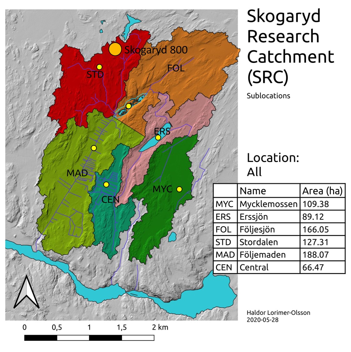
Overview of the Skogaryd Research Catchment with its sub-catchments.
Creator: Haldor Lorimer-Olsson.
The tour followed along the different ecosystems and the monitoring installations, which are explained in more detail in the following paragraphs. The starting point was Skogaryd 800 (address to use for a google search), which served as the base camp during the stay.
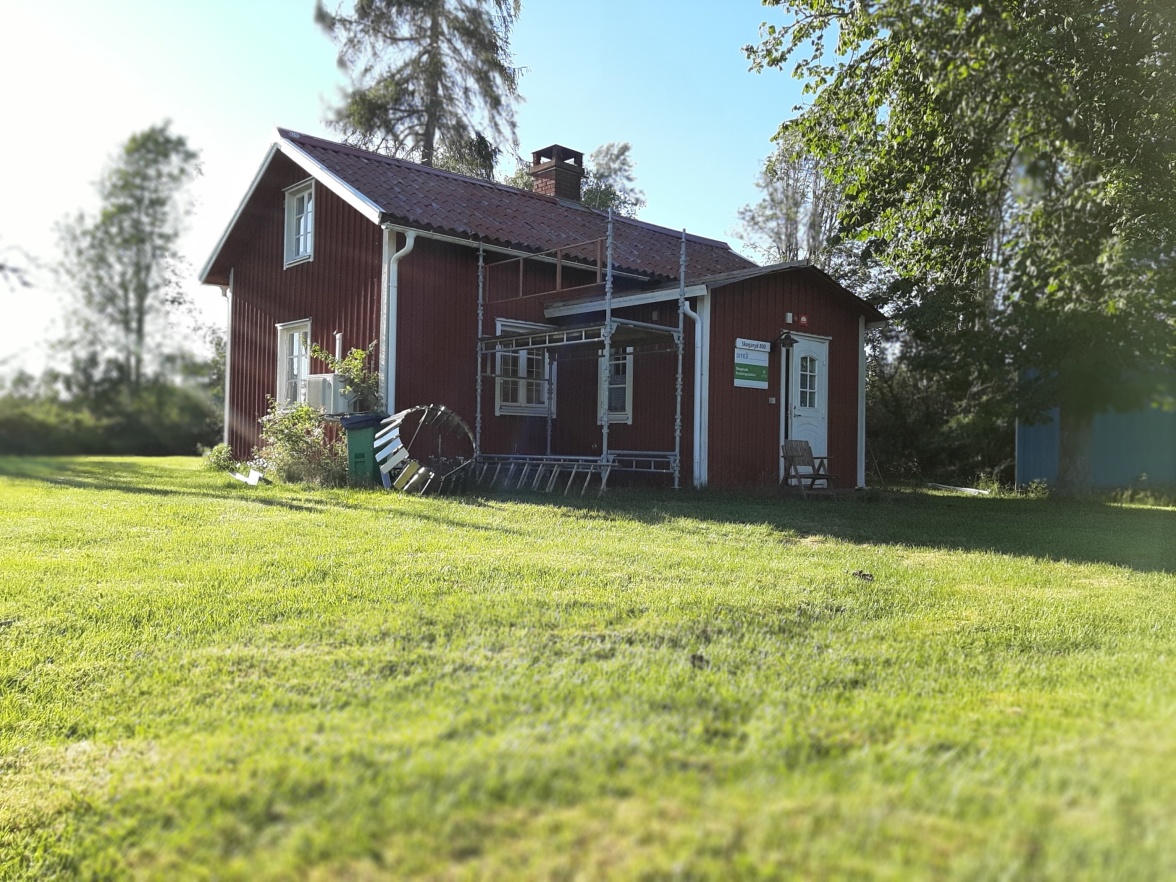
Skogaryd 800 – the so called “Torpet” house, one of two accommodations on site. Photographer: HV
The main research catchment is divided in six sub-catchment with unique features – one of which is Följesjön, the first visit during the stay. This sub-catchment is mainly represented by a lake which is in progress of siltation. On site installations monitor plant succession with phenology cameras and the biogeochemical fluxes with eddy covariance towers.
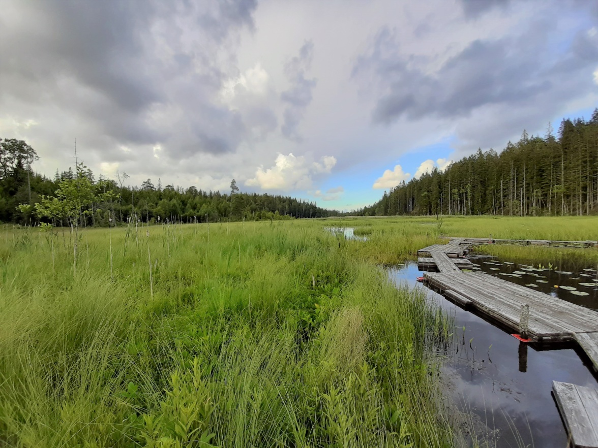
Siltation processes ongoing at Följesjön. The eastern part of the lake still has open water patches, while the western part is already fully overgrown. Photographer: HV
One unique feature of the installations at Lake Följesjön is a 3D-Skygas equipment, which can measure greenhouse gas fluxes in 3 dimensions across an approximately 500 square meter large area over Följesjön. The system is developed by a research group at the University of York (Great-Britain) and is the only one in existence on that scale.
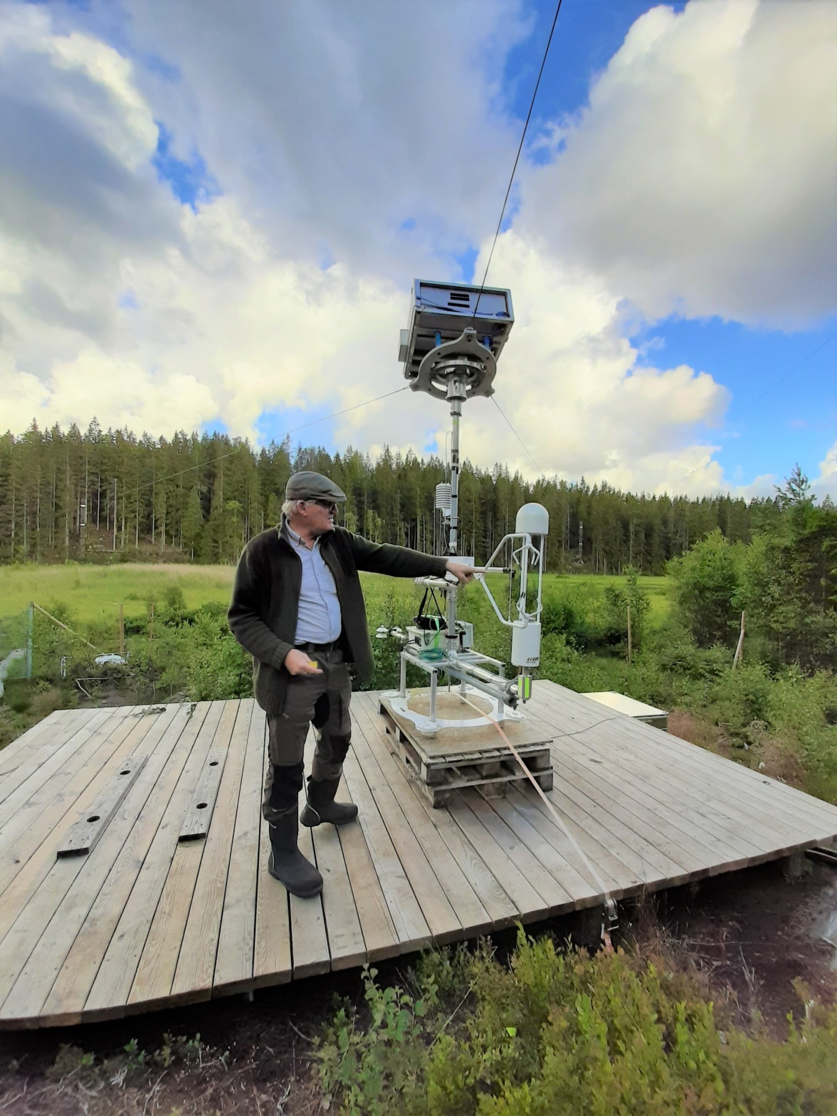
3D-Skygas equipment functioning like a birds-eye soccer stadium camera to monitor greenhouse gas fluxes across a 500 square meter transect. Photographer: HV
Another unique monitoring site is Följemaden which is connected to the runoff from Följesjön and served as the second stop during the tour. The former forest site with highly fertile soil from historical agricultural land use has been clear cut. One part will be rewetted and planted with alder and birch trees this year, the other drained part will be reforested with spruce trees. Micrometeorological flux towers will measure greenhouse gas emissions throughout this process.
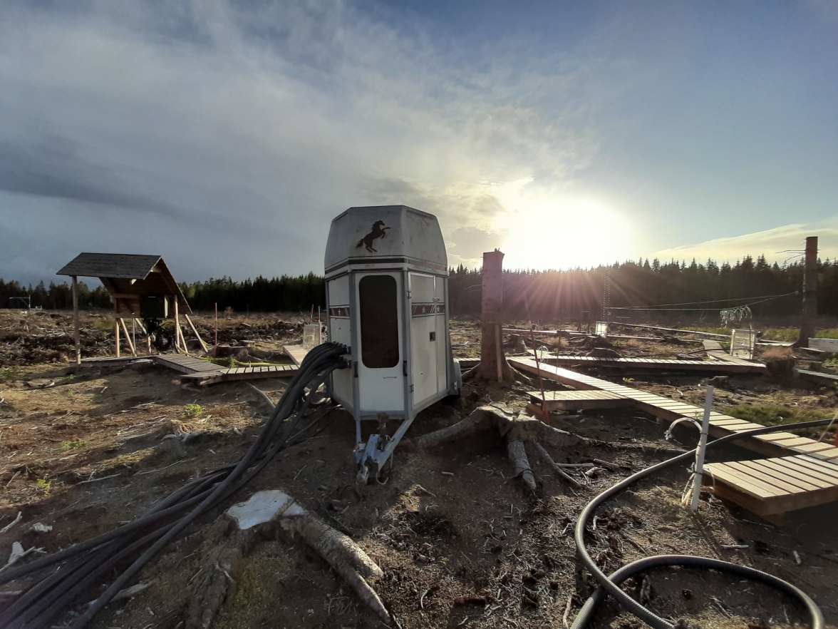
Creative installation at Följemaden, a clear-cut site getting prepared for a control-impact monitoring campaign. Photographer: HV
The last site visited on the first day was the Central sub-catchment with its installation of a 38 meter high flux tower monitors meteorological and biogeochemical parameters at several different heights in a spruce forest on mineral soil. Future planning also includes a control-impact concept for this site. An opportunity to harvest and re-forest parts of the sub-catchment is provided by the land owner. This is a great chance to test and monitor different forest types at Skogaryd Research Catchment in the future.
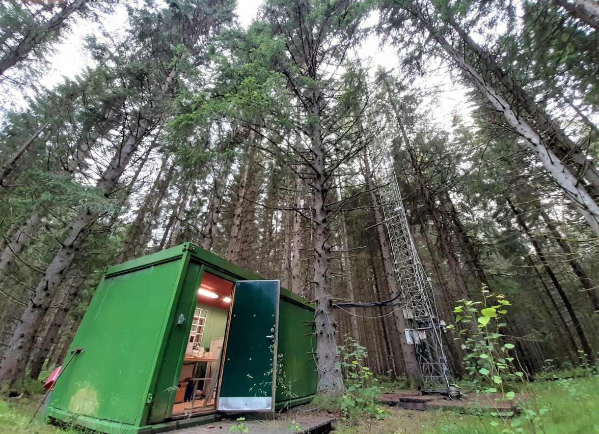
Picture 6 Flux tower at the Central sub-catchment monitoring meteorological and biogeochemical processes in a 60 year old spruce forest. Photographer: HV
On the south eastern side of Skogaryd the mire “Mycklemossen” shows processes of forest succession. Man-made drainage of the ecosystem leads to forest growth on highly fertile soils. Mires are considered to be net CO2 sinks, thus the loss of the mire can lead to large carbon emissions for the atmosphere. An additional negative effect is the loss of species associated with the mire ecosystem, e.g. bird species adapted to open landscape of the mire, will be outcompeted by birds of prey which use the growing trees as observation points. This exciting site in a visual transition phase served as the first stop on the second day.
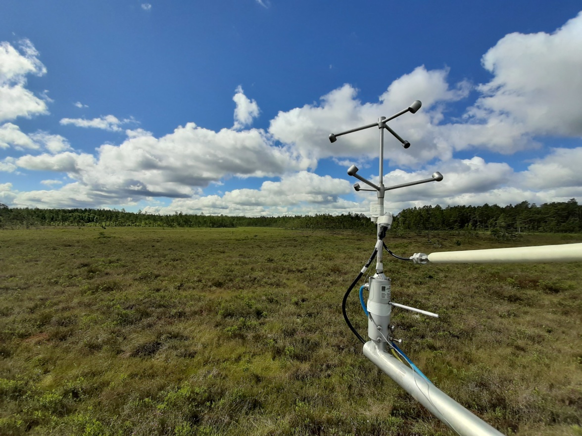
Eddy-covariance system measuring greenhouse gas fluxes over the mire Mycklemossen. Bushes and first pine trees indicated the beginning of forestation which is based on man-made drainage of the area. Photographer: HV
Along several discharge monitoring installations across the whole catchment, Erssjön resembles the main part of the SITES Water programme at Skogaryd. Here, several monitoring campaigns run simultaneously to observe chemical, physical and biological parameters of the limnic systems. The lake can easily be reached from the Mycklemossen mire and was visited as a second stop on the second day.
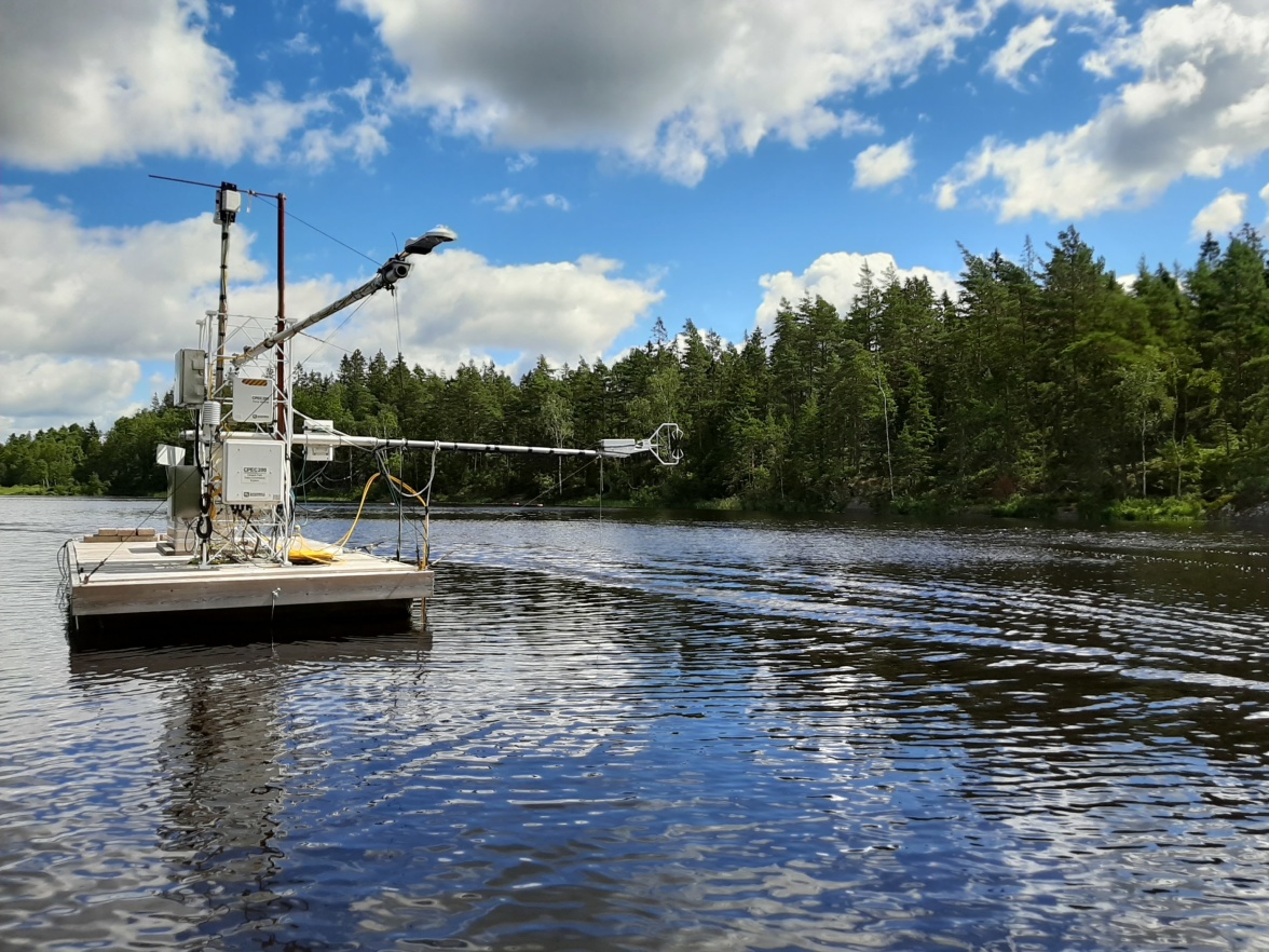
Floating platform at Erssjön equipped with a spectral mast to monitor above surface mechanisms and sub-surface profile installations to observe the limnological processes. Photographer: HV
Like all other SITES Station, Skogaryd Research Catchment is open to use for researchers and the team around the station manager Leif Klemedtsson welcomes everyone to visit the unique infrastructure. The SITES Secretariat can strongly recommend a guided tour by one of the staff members :) !