Snow records in Röbäcksdalen and Svartberget

04 February 2021
Röbäcksdalen’s 75 cm record snow depth, with the field station building in the background. Photo: Malin Barrlund.
The weather this winter around Umeå in northern Sweden has so far been erratic. Both November and December were unusually warm with little snow, but in January the temperature fell, it started to snow, and multiple snowstorms occurred during a period of just a few days.

Snow situation at Röbäcksdalen
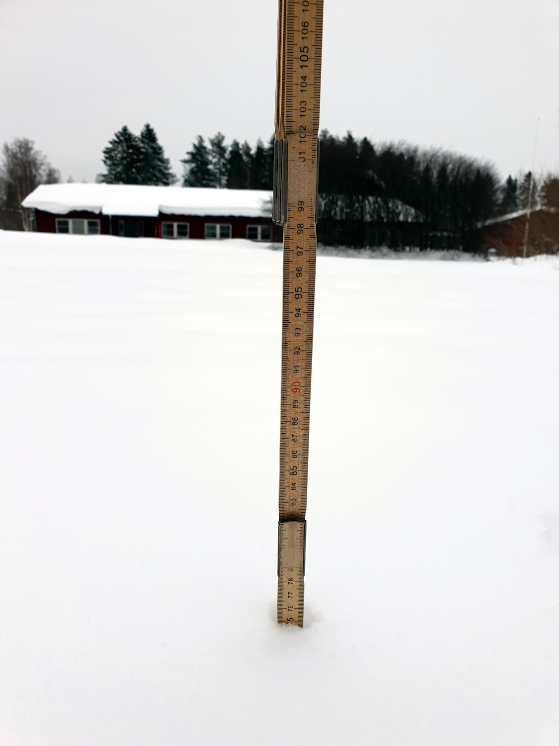
Röbäcksdalen Field Research Station is measuring snow depth since 2010. So far this season, 75 cm of snow have accumulated at the station, which is the deepest snow cover since the recording started. Usually, the highest snow depths are measured later in the season which shows the magnitude of the current situation and that there is a possibility for more snow to come before this winter is over. Almost a meter of snow at Svartberget – a record for January
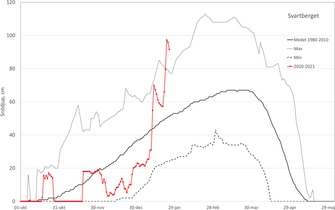
At Svartberget research station, about an hour drive inland from Umeå, the snow depth increased with over 60 cm during the period with several snowstorms in January, which added onto the already existing snow cover.
Image removed.
Digging out field equipment (this one is measuring ozone) is a big challenge this year at Svartberget. Photo: Pernilla Löfvenius.
Svartberget has measured snow depth since 1980 and the record so far is from 1988 when 113 cm was recorded. A lot of the snow that year fell in February and March. The accumulated 97 cm of snow this January is the deepest ever recorded so early in the season, but the most astonishing is in how short time the snow assembled.

The local newspaper refers to old farmer’s traditions, which says that half of winter’s snow should have arrived by now. However, data from previous years at Svartberget show that half the amount of snow usually has arrived by Christmas time and that the maximum snow depth is in the beginning of March. The same data supports the likelihood that another 10-20 cm of snow will fall before the winter is over. However, the variation between years is large and climate change makes it difficult to predict the weather, especially in the past years.
Snow depth (cm) over a season at Svartberget. The red line shows this season. The dashed line is the the minimum, the black line is the average and the dotted line the maximum for the period 1980-2010.